It was another hot morning when we set off on our walk around the peninsula. The weather will break any day, but we'll make the most of it till then. We mostly followed the GR34, one of the grand routes for walkers in France, in this case a coastal walk, but we were only doing a tiny fraction of its length. It was hot, damned hot and it turns out there are no shops at this end of the peninsula once we'd started.
 |
| Anyone recognise these berries/fruit? They're about marble sized and are on trees rather than bushes. |
 |
| The French navy was on patrol in the roads. In this case Premier-Maître L'Her (F792), though we saw two more smaller ships stooging around |
 |
| The first French battery, just 30 minutes into our walk |
 |
A log building - unusual in these parts. Not part of the local vernacular as Monte Don might say
|
 |
| GR34. What a view! |
Did I mention it was hot. We were sweating pretty soon, and regretting not bringing more liquids with us. This part of France was occupied by the Spanish in the 17th C after an unsuccessful attack on Brest. They were pretty quickly booted out but the name stuck - Pointe des Espagnols. Realising that Brest was a bit vulnerable the French started to upgrade the defences. Some simple guardhouses to start with. 'Model towers' as they were all built to the same plan. Then in the 17th C Vauban got involved.
[I suggest that if you aren't interested in military history you should stop here.]
 |
| The port of Brest, the second biggest for the French navy, and biggest on the Atlantic coast. The citadel is centre of pic. |
 |
| German sub pens. Brest was a critical part of their naval ops while they had a navy as it was the only Atlantic port that could handle the big German battleships and battlecruisers. Bismark was headed this way before she was sunk, and Scharnhorst, Gneisenau and Prinz Eugen started their infamous Channel Dash (Op Cerberus) from here. The sub pens supported over 200 subs in their anti-shipping war. (See After the Battle Vol 55) |
 |
| Fort du Mengant on the north (Brest) side of the 'Goulet', the throat leading to the Brest roads. Paired with Fort de Cornouailles on this side it was intended to stop battleships passing through the strait. |
 |
| Fort Portvic on the Brest coast. I thought these were German emplacements but they may be late 19th French. |
 |
Vauban - if you can read French
|
 |
| The French battery at Pointe des Espagnols |
 |
| The view from Pointe des Espagnols that shows it's strategic importance. |
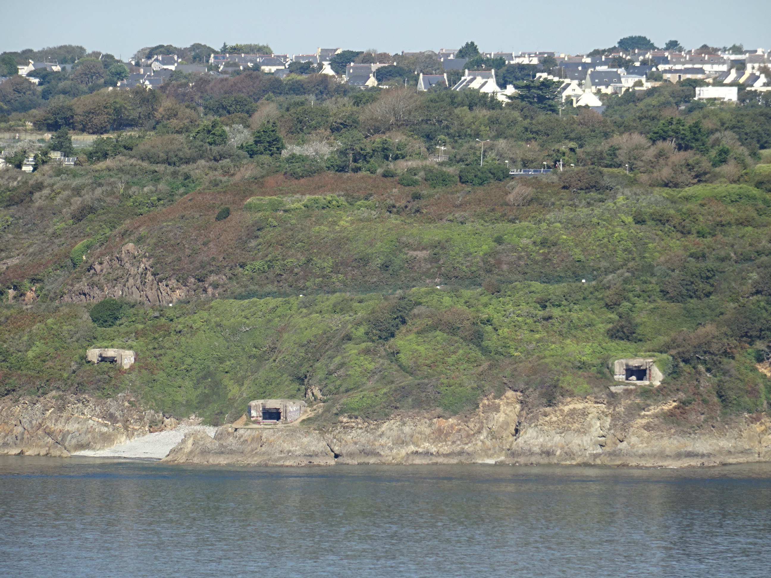
From the Pointe des Espagnols there were a series of forts down the coast. French built between the 17th and 19th C they are mostly covered in vegetation now. However there were a couple of outstanding features.
 |
| Batterie de Cornouailles low in the distance. |
 |
| Batterie de Cornouailles (does that sound like Cornwall?). This looks as if it is a simple platform for guns, but in fact it is a little more complicated. It is built low to the water and buried under the platform were emplacements for guns that could only fire straight ahead through a tunnel. The guns were installed and then blocked in afterward. They were intended to fire low and straight at ships hulls as they passed and were immune to return fire. (The theory was never tested.) |
 |
| Ilot des Capucins - more on this later |
 |
A Panhard armoured car. God knows why it's there.
|
In 1944 the Americans attacked Brest. It was defended by the German 2nd Fallschirmjaeger Division, the 343rd Division and a large number of troops from other divisions who had made their way there. The commander, the ardent Nazi General Ramcke oversaw the destruction of the port that was so thorough it was ruled out as a supply base for the duration of the war. The defence was also so bitter that the allies decided not to try to capture the other fortress ports of Lorient and Nantes, instead just surrounding them containing them until the end of the war. Ramcke escaped from Brest to Ilot des Capucins where I guess he was hoping to catch a boat somewhere, but was captured by Americans before he could. After the Battle Vol 168 covers the battle.
 |
| Ramcke asked the credentials of the officer asking for his surrender (as he wanted to surrender to a high ranking officer). The American pointed to his men and said "These are my credentials". Ramcke surrendered. |
 |
| Ilot des Capucins view |
 | The steep tunnel down to the gun rooms
|
 |
| This was an unusual port and I thought it might be for torpedoes. It turns out to be another battery like the Battery Cornouailles where the gun has no lateral movement. |
 |
| Two such guns were installed in 1890 in these two rooms dug deep into the island |
 |
Presumably the commandant's house and offices but showing heavy damage from gunfire
|
 |
| The island. The path down was a bit dodgy as the steps had worn away and there were some high cliffs should you place a foot wrong. The island wasn't a Capucin monastery as I first thought, but is so named after a rock that looks like a praying monk (which I didn't take a picture of). |


No comments:
Post a Comment